What Weather Apps Miss: The Subtle Winter Signals Only Forecasters Notice Before a Disruptive Day
Most Canadians rely on weather apps to plan their mornings, especially during winter. These apps are helpful for quick checks, but they often miss the subtle signals that can turn a calm morning into a disruptive one. As a Certified Weather Forecaster with more than eight years of experience, and as the creator of Snow Day Calculator Canada, I have learned that winter storms often give quiet clues long before an app detects any change. Those clues can mean the difference between a normal school day and a dangerous commute.
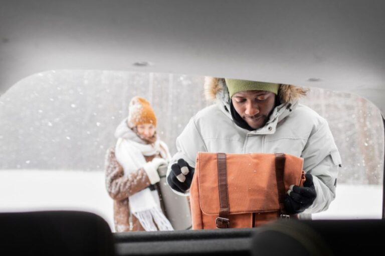
One morning in Waterloo stands out clearly in my memory. My app showed nothing more than flurries, yet the sky carried a texture that made me pause. Within two hours, a thin layer of freezing drizzle coated the roads. Parents were baffled, and several messaged me asking why the conditions seemed so different from what their apps predicted. That morning reminded me that winter storms often whisper before they roar.
Why Weather Apps Struggle During Canadian Winters
Weather apps are powerful digital tools, but their strength lies in convenience, not nuance. Apps rely heavily on automated model output. This means they often miss rapid shifts, localized impacts, or subtle atmospheric changes that trained forecasters identify quickly.
Apps excel at predicting broad trends such as major systems or temperature swings. However, Canadian winters are shaped by lake effect snow, coastal moisture, shallow arctic air, sudden temperature flips, wind driven bands, and local geography that apps usually smooth over. These details can change conditions in minutes.
A perfect example occurred in Calgary. Apps confidently predicted warming in the east end of the city, yet a chinook shadow remained in place for hours. Drivers in that zone faced icy roads while nearby neighbourhoods warmed. This divide was clear to forecasters, yet the apps did not reflect it.
Subtle Signal 1: Low Level Moisture That Models Often Miss
Shallow moisture is a classic winter challenge. Models may miss thin moisture layers at ground level, yet those layers can produce freezing drizzle, fog, or light icing.
In Brandon, every app predicted a simple cloudy morning. After checking temperature and humidity profiles, I saw a thin moisture layer forming beneath an inversion. I predicted freezing drizzle, and it started just after dawn. Rural roads glazed over, and many drivers later commented that the conditions caught them off guard. The signals were subtle, but they were clear to anyone who knew where to look.
Subtle Signal 2: Temperature Mismatches Near the Surface
Apps usually show a single temperature. Forecasters monitor several layers, including road temperature, which can differ significantly from the air.
In Ottawa, the air temperature appeared steady on apps, but I could see road temperatures dropping quickly. When moisture arrived, roads froze almost instantly. This kind of ground level mismatch is one of the most common reasons winter mornings become hazardous.
Subtle Signal 3: Snow Crystal Clues That Reveal What Happens Next
Most people do not realize that snowflakes carry important information. Their shape, size, and moisture content reveal how snowfall intensity may change.
During a storm in Sudbury, flakes suddenly shifted to a dendritic pattern. These flakes accumulate quickly, and I knew the snowfall rate was about to increase. The models showed moderate snow, but the crystals told a different story. Within an hour, the accumulation rate doubled.
Apps cannot read snow crystal structure, but forecasters use it as a reliable indicator of what will unfold next.
Subtle Signal 4: Atmospheric Fingerprints That Apps Cannot Detect
Some atmospheric features are too localized for apps to interpret. These include:
- narrow mesoscale bands
- dry slot intrusions
- deformation zones
- low level jets
- sharp wind shifts
- shallow lifting zones
Each of these affects winter mornings in different ways.
I recall a day in Hamilton when a narrow band developed over the region. It lasted only an hour but caused major delays and local whiteout conditions. Apps reported light snow, yet the ground truth was dramatically different. Forecasters saw the boundary forming well before the first flakes fell.
Subtle Signal 5: How Local Geography Shapes Winter Outcomes
Canadian geography creates micro environments that apps rarely capture. Hillsides, lakes, tree corridors, and valleys each influence winter weather in their own way.
In St. John’s, two roads only minutes apart had completely different conditions. One road sat in a sheltered dip and iced over twice as quickly as the surrounding area. Apps showed the same forecast for both locations, but the actual conditions were very different.
Forecasters rely heavily on local knowledge because these geographical quirks repeat year after year.
Case Study: A Disruptive Day That Apps Did Not See Coming
Several winters ago, model output suggested light flurries and minimal risk for Southern Ontario. Apps were optimistic. However, several cues stood out to me.
Ground level humidity rose slightly, radar showed a strengthening band near Lake Huron, and temperatures dipped along several bus routes. Together, these clues indicated a developing freeze risk.
By sunrise, freezing drizzle formed across multiple regions. Buses were delayed, several school boards issued partial closures, and drivers faced challenging roads. Apps updated only after conditions deteriorated.
This event perfectly illustrated the value of human interpretation when conditions evolve quietly but quickly.
Where Tools Like Snow Day Calculator Canada Fit Into the Picture
Parents across Canada often feel uncertain when storms approach, especially if apps show conflicting information. This uncertainty is one of the reasons I created Snow Day Calculator Canada. The goal was to combine large scale model data with the subtle cues that forecasters track, including timing shifts, temperature mismatches, and regional vulnerability.
The calculator highlights early risk conditions and factors them into a school day context. It helps families see the signals that apps may overlook, especially on mornings when timing matters more than snowfall amount.
As a forecaster, I designed the tool to bridge the gap between automated output and expert interpretation. It is most effective when used alongside local forecasts and personal observation.
Conclusion: Why Human Insight Still Matters in a Digital Forecasting World
Winter forecasting in Canada will always require a balance between technology and human insight. Apps provide broad trends, but subtle atmospheric cues often determine whether a day will be smooth or disrupted. These cues include low level moisture, snow crystal shifts, temperature changes near the surface, and narrow snow bands.
One of the most rewarding parts of my job is identifying these quiet signals before anyone else notices them. It allows me to help families stay safe and informed, especially on days when conditions change suddenly.
With a better understanding of the clues that weather apps miss, Canadian families can face the winter season with more confidence and less confusion. Human expertise remains an essential part of navigating winter, and it always will.